
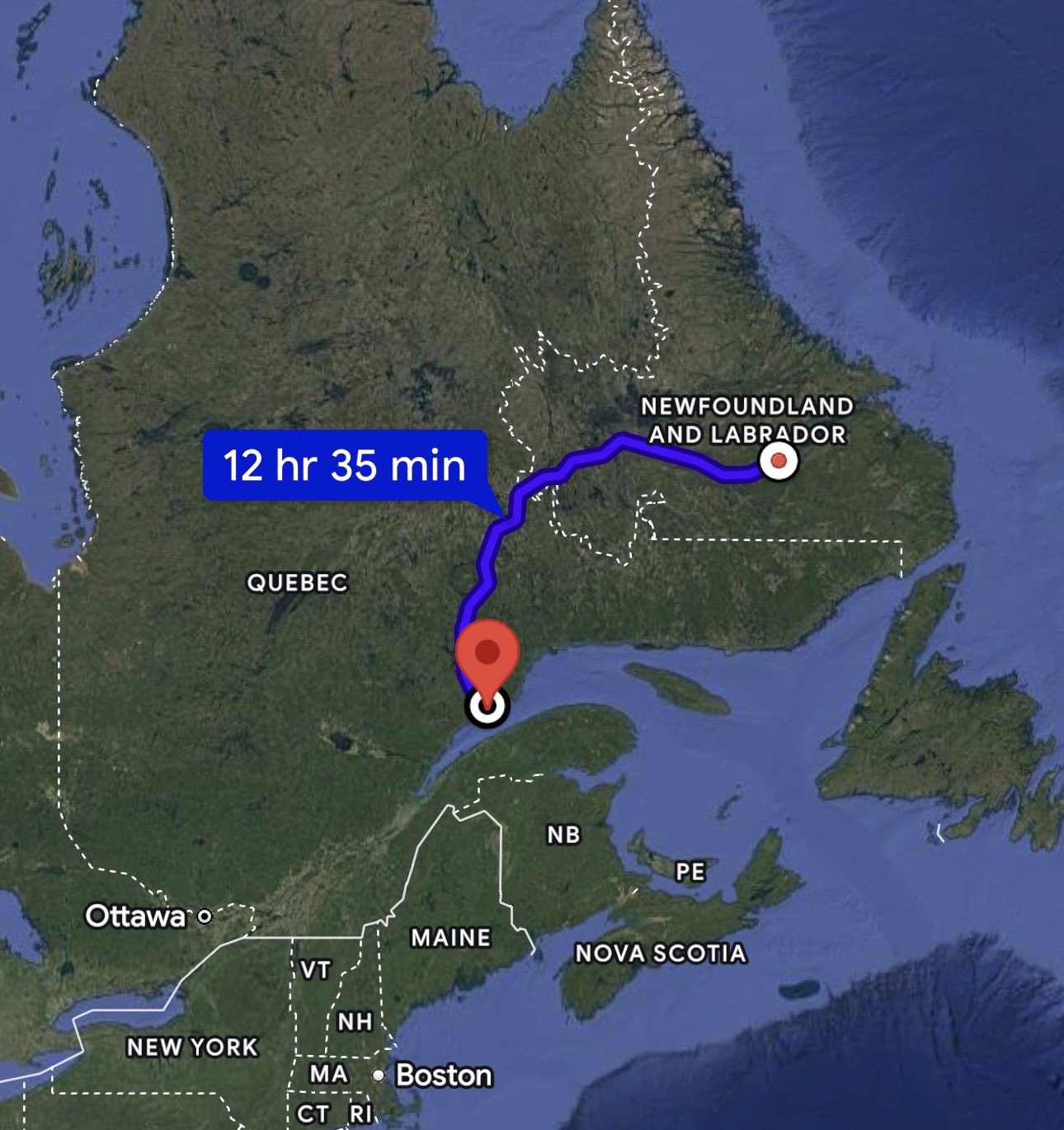
A solo traveler crossing northeastern Canada has offered a vivid example of what satellite connectivity can mean far beyond a speed test. In a video shared July 17, the driver said Starlink was “saving my life” while she traveled the remote Trans-Labrador Highway through Labrador and northern Quebec. The statement was personal rather than an official emergency-services assessment, but it captures a real change: travelers can now carry an internet link into places where cellular coverage may be limited or absent.
A connected journey across an unusually remote route
The Trans-Labrador Highway is not an ordinary commuter road. Government sources describe more than 1,100 kilometers of paved highway between Labrador West and the Labrador Straits, crossing sparsely populated terrain with long distances between communities and services. Weather, wildlife, mechanical trouble and changing road conditions can turn a routine delay into a serious planning problem. Connectivity cannot remove those risks, but it can help a traveler reach weather information, maps, accommodation details or other people when a phone has no conventional signal.
The account came from Josh West, who shared the traveler’s video rather than documenting the trip himself. That makes the post a credible discovery signal, not independent proof that Starlink resolved a specific life-threatening emergency. The more defensible conclusion is that the traveler felt materially safer and less isolated because she had a working connection during an ultra-remote drive.
Why Starlink Roam changes remote travel
Starlink describes its Roam service as designed for land-based travel, camping and nomadic use in areas with active coverage. The company also cautions that performance is not guaranteed and can vary with geography and congestion. A satellite terminal needs power and a usable view of the sky, while trees, terrain, weather or equipment problems can interrupt service. It should therefore be treated as one layer of a travel plan—not a replacement for fuel reserves, food, water, vehicle preparation, offline maps or an emergency beacon where appropriate.
Connectivity becomes part of the safety checklist
What makes this story important is not the drama of one quotation. It is the way satellite internet is moving from a specialist tool into ordinary vehicle travel. Drivers can share a location, check a closure, contact family or look up assistance without waiting to reach the next town. That can reduce uncertainty, which is often the most stressful part of traveling alone in an unfamiliar remote region.
Practical takeaway: Remote connectivity is valuable, but travelers should still download maps, confirm fuel stops, monitor official road and weather reports, carry emergency supplies and tell someone their route and expected arrival time.
A small story with a larger infrastructure lesson
Broadband policy is usually discussed in terms of homes, schools and businesses. The Trans-Labrador account highlights another use: temporary, mobile access on the road. As portable satellite systems become easier to carry and power, internet coverage is no longer tied only to towers or fixed buildings. For people crossing northern Canada, that shift can turn a long silent stretch into a route where help, information and human contact remain within reach—provided the technology is used with realistic expectations and a complete safety plan.
Sources
· Josh West — traveler video and account on X
· Government of Newfoundland and Labrador — Trans-Labrador Highway paving completion
Share:
Tesla Opens Six-Stall 1.2MW Megacharger in Bloomington, California for Tesla Semi
BYD King DM-i Launches in Mexico With 1,680-Km Range